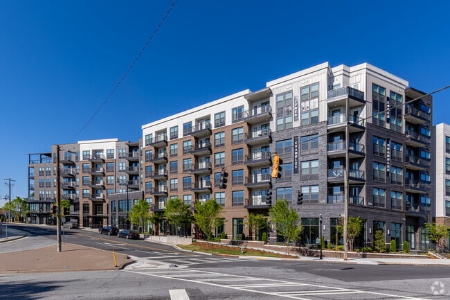
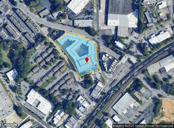
Property Record
2175 American Way, Atlanta, GA 30341
Current Lease Availabilities
NEARBY LISTINGS FOR SALE OR LEASE
Property Detail
2175 American Way
18-308-18-010
119 X 69 X 82
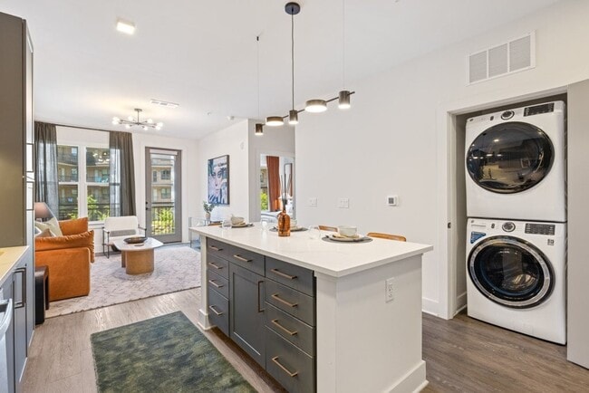
Apartment
DeKalb
X
Georgia
13089C0018K
10
2025
3.40 AC
2025
Downtown Chamblee
021208
Atlanta
276,504 SF
Atlanta-Sandy Springs-Roswell, GA
DEMOGRAPHICS near 2175 American Way
1 Mile
3 Mile
5 Mile
2024 Total Population
11,246
106,802
303,809
2029 Population
11,397
106,586
306,057
Pop Growth 2024-2029
+ 1.34%
(0.20%)
+ 0.74%
Average Age
35
36
37
2024 Total Households
4,741
44,740
130,113
HH Growth 2024-2029
+ 2.19%
(0.15%)
+ 0.85%
Median Household Inc
$74,894
$84,258
$89,350
Avg Household Size
2.30
2.30
2.30
2024 Avg HH Vehicles
1.00
2.00
2.00
Median Home Value
$397,955
$460,465
$476,747
Median Year Built
1993
1985
1986
Nearby Places
- Restaurants
- Banks
- Shops
- Fitness
- Groceries
PUBLIC TRANSPORTATION
TRANSIT/SUBWAY
Chamblee (Gold Line - Metropolitan Atlanta Rapid Transit Authority (MARTA))
DRIVE
WALK
Distance
Chamblee (Gold Line - Metropolitan Atlanta Rapid Transit Authority (MARTA))
2 min
10 min
0.5 mi
COMMUTER RAIL
Atlanta (Crescent - Amtrak)
DRIVE
WALK
Distance
Atlanta (Crescent - Amtrak)
16 min
9.4 mi
AIRPORT
Hartsfield - Jackson Atlanta International
DRIVE
WALK
Distance
Hartsfield - Jackson Atlanta International
35 min
22.7 mi
Freight Ports
Georgia Ports - Savannah
DRIVE
WALK
Distance
Georgia Ports - Savannah
295 min
262.2 mi
Nearby Properties
Address
Land Use
TOTAL SIZE
Lot Size
Zoning
Address
Land Use
TOTAL SIZE
Lot Size
Zoning
705,518 SF
39.09 AC
M
Address
Land Use
TOTAL SIZE
Lot Size
Zoning
12,600 SF
508.30 AC
M
Address
Land Use
TOTAL SIZE
Lot Size
Zoning
376,010 SF
3.76 AC
OI
Address
Land Use
TOTAL SIZE
Lot Size
Zoning
299,993 SF
4.72 AC
I1
Address
Land Use
TOTAL SIZE
Lot Size
Zoning
701,195 SF
20.76 AC
X
Address
Land Use
TOTAL SIZE
Lot Size
Zoning
439,052 SF
4.57 AC
OI
Address
Land Use
TOTAL SIZE
Lot Size
Zoning
519,706 SF
6.70 AC
X
Address
Land Use
TOTAL SIZE
Lot Size
Zoning
213,408 SF
6.35 AC
I1
Address
Land Use
TOTAL SIZE
Lot Size
Zoning
296,627 SF
9.21 AC
X
Address
Land Use
TOTAL SIZE
Lot Size
Zoning
542,845 SF
10.58 AC
X
Address
Land Use
TOTAL SIZE
Lot Size
Zoning
432,424 SF
3.87 AC
MC
Address
Land Use
TOTAL SIZE
Lot Size
Zoning
191,941 SF
3.02 AC
OCR
Address
Land Use
TOTAL SIZE
Lot Size
Zoning
140,183 SF
4.20 AC
OI
Address
Land Use
TOTAL SIZE
Lot Size
Zoning
103,056 SF
8.66 AC
OI
Address
Land Use
TOTAL SIZE
Lot Size
Zoning
157,133 SF
5.03 AC
M
Address
Land Use
TOTAL SIZE
Lot Size
Zoning
166,377 SF
7.56 AC
X
Address
Land Use
TOTAL SIZE
Lot Size
Zoning
283,784 SF
30.88 AC
RM100
Address
Land Use
TOTAL SIZE
Lot Size
Zoning
204,376 SF
14.23 AC
X
Address
Land Use
TOTAL SIZE
Lot Size
Zoning
106,770 SF
3.13 AC
X
Address
Land Use
TOTAL SIZE
Lot Size
Zoning
366,276 SF
11.54 AC
RM-HD
Address
Land Use
TOTAL SIZE
Lot Size
Zoning
457,330 SF
20.49 AC
RM-HD
Address
Land Use
TOTAL SIZE
Lot Size
Zoning
345,441 SF
25.78 AC
C1
Address
Land Use
TOTAL SIZE
Lot Size
Zoning
144,380 SF
3.84 AC
X
Address
Land Use
TOTAL SIZE
Lot Size
Zoning
395,191 SF
2.78 AC
OIC
Address
Land Use
TOTAL SIZE
Lot Size
Zoning
267,983 SF
13 AC
X
Address
Land Use
TOTAL SIZE
Lot Size
Zoning
253,055 SF
2.65 AC
X
Address
Land Use
TOTAL SIZE
Lot Size
Zoning
214,915 SF
3.55 AC
Address
Land Use
TOTAL SIZE
Lot Size
Zoning
406,188 SF
4.43 AC
X
Address
Land Use
TOTAL SIZE
Lot Size
Zoning
325,232 SF
23.10 AC
X
The World's #1 Commercial Real Estate Marketplace
Connect with us
© 2025 CoStar Group
The information above has been obtained from sources believed reliable. While we do not doubt its accuracy we have not verified it and make no guarantee, warranty or representation about it. It is your responsibility to independently confirm its accuracy and completeness. Any projections, opinions, assumptions, or estimates used are for example only and do not represent the current or future performance of the property. The value of this transaction to you depends on tax and other factors which should be evaluated by your tax, financial, and legal advisors. You and your advisors should conduct a careful, independent investigation of the property to determine to your satisfaction the suitability of the property for your needs.